
Citizens Make a Difference Together at Transport for Cairo – Now in Arabic!
[Note: Complete text in English below]
كيف يصنع المواطنون فرقا في النقل للقاهرة
القاهرة، مصر، النقل، المناطق الحضرية، التخطيط الحضري
نهاية عنوان المقدمة
المؤسس المشارك ل”القاهرة من الأساس” نيكولاس هاملتون يحاور مؤسسا “مواصلة للقاهرة” محمد حجازي وحسام العقدة.

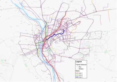
.رسم توضيحى لخطوط أتوبيات النقل العام ومترو القاهرة- الطرق والمحطات بواسطة “مواصلة للقاهرة”
كيف بدأت “مواصلة للقاهرة”؟
حسام: ذات يوم كنت أسير في الطريق وتلقيت مكالمة مشوشة من حجازي -صديقى منذ زمن بعيد- وعندها أخبرنى عن مشروع قد علم عنه للتو في نيروبى.
حكي لي حجازى عن الفريق الذي وضع خريطة لشبكة النقل “غير الرسمية” في المدينة وكيف جعل تلك البيانات متاحة للجميع. وكان المشروع يدعي “Digital Matatus”.
وقال حجازي أنه يرى أن بامكاننا القيام بنفس المشروع في القاهرة حيث تغطى المواصلات الغير رسمية جزءا كبيرا من احتياجات النقل في المدينة. وقد تحمست جدا للفكرة حتى أننى تمهلت عن المشى قليلا، وذهبت إلى أقرب مقهى بالجوار، وفتحت جهاز الكمبيوتر المحمول الخاص بى وبدأت البحث. كنت قد أصبحت مهووسا بفكرة كيف بامكاننا -كمواطنين- أن نوفر لملايين المصريين الوصول إلى تلك المعلومات المفيدة حول شبكة النقل الحالية وتمكينهم من إستخدام هذه المعلومات لتحسين حياتهم اليومية. وفي ذلك اليوم حددنا الأساسيات المنهجية لأبحاثنا ومن هنا بدأت “مواصلة للقاهرة”.
ولكن ما هي علاقة البيانات بالمواصلات داخل المدينة؟ وماذا تأمل أن يحققه هذا المشروع؟
حسام: إن الهدف الأساسى من هذا المشروع هو تسهيل إستخدام الناس لوسائل النقل العام في القاهرة. قبل أن تتمكن من التفكير في إدخال تحسينات على نظام النقل، يجب عليك أولا أن تفهم النظام الذي تملكه. ونريد إيصال تلك البيانات لأكبر عدد ممكن من الناس. نريد أن يستخدمها سائقى وسائل النقل العام والخاص والباحثين ومطوري التطبيقات الخاصة بالمواصلات والجمهور أيضا، لفهم النظام كما هو.
محمد حجازي: إذا ما قمت بزيارة موقعا الكترونيا خاصا بتخطيط الرحلات مثل Gooogle maps أو Bey2ollak– والذي يعد واحدا من أشهر التطبيقات في مصر اليوم- فسوف يزودوك باتجاهات للقيادة فقط، وربما في بعض الأحيان اتجاهات للمشي أيضا، ولكن ليس في استطاعتهم ان يزودوك بالخيارات المتاحة لك لاستخدام شبكة المواصلات العامة، لأن تلك المعلومات والبيانات لم يتم جمعها بالأساس كما أنها غير متاحة حتى الآن أيضا، الأمر الذي يشجع المواطنين على استخدام سيارات النقل الخاصة لعدم وجود مصدر موثوق للمعلومات يمكن الاعتماد عليه بخصوص خيارات النقل العام.
لقد بدانا فكرة وضع مخطط لخطوط الميكروباصات بالقاهرة حيث أنه لا توجد مخططات لهذا لذلك النوع من المواصلات حتى الآن، وقد حاولنا دمج تلك المعلومات مع المخططات الحكومية عن وسائل النقل العامة الرسمية التي تشمل الاتوبيسات وخطوط المترو، والتي يمكن اتاحتها سواء للجمهور أو مطوري البرمجيات أو الباحثين. ولكننا سريعا ادركنا عدم وجود هذه المعلومات عن المترو أو الاتوبيسات المملوكة للحكومة، وبالتأكيد لا توجد للميكروباصات.
لصنع خريطة وبرنامج قوي لتخطيط الرحلات فأنت فى حاجة الى بيانات قياسية عن أكثر من شىء، مثل الطرق، والمحطات، وطول الطرق. تحتاجها في شكل نوع من برمجة البيانات يسمي GTFS أو General Transit Feed Specification.
وهذا ليس سهلا في أفضل الظروف، ولكننا بحاجة لفهم مدي حجم شبكة المواصلات في القاهرة وعمق تعقيدها. فالقاهرة الكبري يسكنها نحو 18 مليون نسمة، يصلوا إلى 20 مليون خلال أيام الأسبوع خلاف العطلات، ويزدادوا سكنيا وعمرانيا بشكل متسارع جدا، ويحتوي مترو القاهرة على 61 محطة، بطول 65 كم ومازال يتوسع ويمتد، وهناك مايقرب من 450 الي880 خط أتوبيس مملوك للحكومة، ولكن كلاهما لا يشبع الخدمات المطلوبة للنقل في القاهرة، لذلك فلدينا أيضا خدمات النقل غير الرسمية من الميكروباصات، والتي تنقسم داخليا هي الاخري إلى هؤلاء المصرح لهم بالعمل بخطوط سير محددة، وآخرين غير مصرح لهم بذلك ويسلكون مسارات مختلفة اشبه ماتكون بالتاكسي المشترك.
لا أحد يعلم حقيقة عددهم بدقة، وماهي الطرق التي يسلكونها، ولا عدد الافراد الذين يستقلوها، ولكن التخمينات تقول بان ذلك النوع يغطي 40% من احتياجات النقل بالمدينة، والتي تكاد تساوي نسبة مستخدمي النقل العام.
اذا ماهي طريقة سكان القاهرة للحصول على معلومات السير حاليا؟ وكيف تختلف عن الطرق الاخري؟
حسام: إن معظم المعلومات الخاصة باستخدام شبكة النقل العام في الوقت الحالي يتم تداولها شفهيا، وتوجد ضبابية كبيرة حول مدي صدقها والخيار الأسرع المتاح بالفعل، وباتاحة كافة المعلومات للجمهور ستكون معرفة أسرع المسارات وأرخصها في متناول اليد للجميع، سيكون بامكان التطبيق الخاص بنا على أي تليفون ذكى ان يخبرك كيفية الوصول لأي مكان ومدي مدة رحلتك اليه تقريبا.
محمد حجازي: باستثناء المترو فالمعلومات المتاحة لي كمواطن قليلة جدا. تقوم الحكومة بنشر ملف pdf لمسارات الطرق الخاصة بأتوبيسات النقل العام فقط، وهذا هو كل شيء. حتى عند توفر تلك البيانات فانها تكون غير متاحة للعامة ولايمكن استخدامها أيضا لتخطيط الرحلات.
هل نحتاج اذن لهاتف ذكي حتى نستفيد من “مواصلة للقاهرة”؟
حسام: هناك تصور خاطئ كبير عن أن الناس في الدول النامية لايملكون هواتف ذكية، في مصر. مستخدمي الهواتف الذكية – الذين يملكون أيضا خططا للانترنت من خلال الهاتف- يصل إلى 15.5 مليون مستخدم، والعدد في تزايد مستمر، ومن المتوقع على مدي السنوات الثلاث القادمة أن يرتفع العدد إلى 28 مليون مستخدم، ما يمثل أكثر من 50% من نسبة الشباب بالدولة.
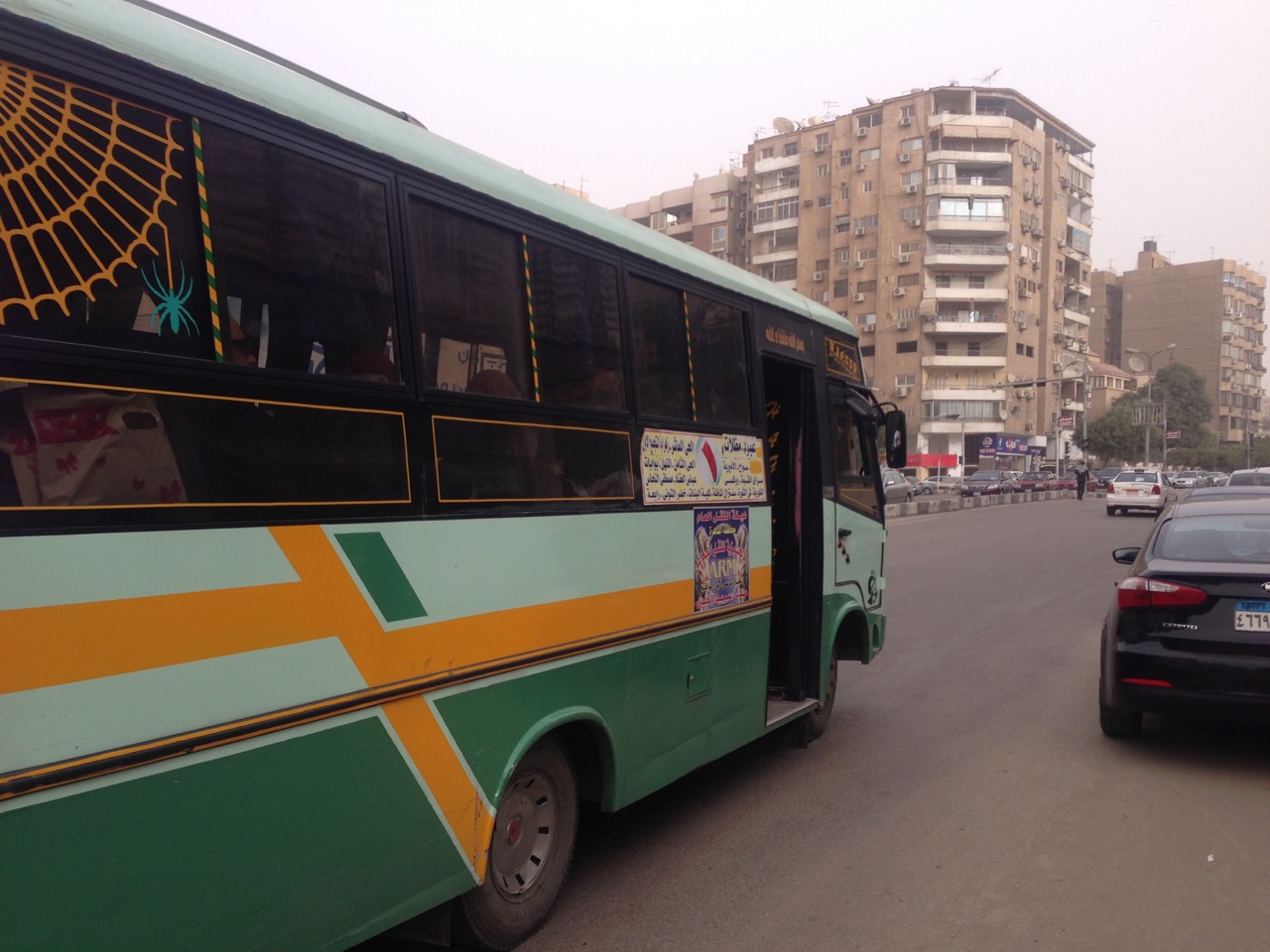
ميني باص قطاع خاص يعمل بتصريح من السلطات الحكومية “رخصة المشاع الإبداعى CC-0”.
محمد حجازي: دعني أوضح تصورا آخر خاطئا، مستخدموا النقل العام ليسوا فقط من الطبقة الفقيرة، كل الناس يقومون باستخدام وسائل النقل العامة، ومستخدمو الهواتف الذكية أيضا يزدادون في وسائل النقل العام، هذه حقيقة.
كل مكان في العالم الآن أصبح مغطي بشبكات الإنترنت اللاسلكية wifi وشبكات الاتصالات تمتد وتعمل حتى بداخل أنفاق المترو. وأيضا في أثناء.
يمكن إنتاج خرائط مطبوعة يمكن حملها. واخيرا هناك تصور خاطئ نستطيع مناقشته، حيث أنه ليس بالضرورة ان تكون التغيرات على مستوى عالمي كي تكون مفيدة، بل يمكن لتطور صغير أن يكون له تأثيرا ايجابيا كبيرا بل ويستحق الاشادة أيضا.
لقد ذكرت مسبقا أن مشروع Digital Matatus كان في نيروبي، أنا معجب بشدة بالمشروع وكان لي الشرف أن أكون واحدا ممن شاركوا به منذ بدايته. هل بامكانك ان تصف لنا كيف تم تطبيق هذا المشروع؟ وكيف كانت “مواصلة للقاهرة” مختلفة؟
محمد حجازي: لقد تعرفت على Digital Matatus من خلال كتاب مجاني على الإنترنت يسمي “مابعد الشفافية” أو “Beyond Transparency” ، وعلمت الكثير بعد ذلك من خلال مصارد أخرى تهتم بالعمران مثل Wired و Atlantic و Guardian و العديد من الأوراق العلمية الأخري أيضا.
ظل الفريق هناك لأشهر متعددة يستخدم The Matatus لتسجيل آلاف المحطات ومئات الطرق بواسطة تطبيق خاص وجهاز تحديد المواقع الجغرافية GBS.
وطلبنا النصيحة من أحد الاكاديميين في احدي الجامعات المشاركة في المشروع جاكلين كلوب الأستاذ بمعهد التطوير الحضرى المستدام بجامعة كولومبيا، وسارة ويليامز مديرة معمل تصميم البيانات المدنية بمعهد ماساتشوتس للتقنية، (تنويه: دكتور كلوب هي أيضا مستشار ب “القاهرة من الأساس”).
ومن هنا عرفنا مدي اهمية المشاركة المؤسسية “مشاركة المؤسسات” لتنفيذ هذا العمل بنجاح.
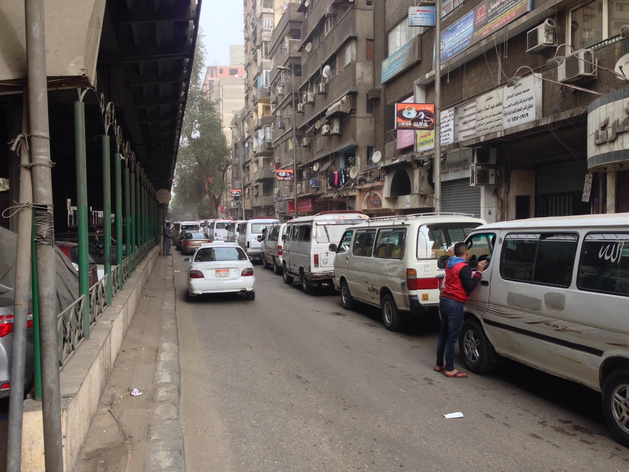
اصطفاف عدد من الميكروباصات أسفل كوبري الدقي العلوى “رخصة المشاع الإبداعى CC-0”.
أحد التحديات التي نواجهها هنا في القاهرة انها تصل تقريبا إلى ثلاث أضعاف نيروبي، فبخلاف Matatus نيروبي ، فان شبكة المواصلات بالقاهرة لا ترتكز بشكل أساسي على الميكروباصات فقط، حيث تحتوي القاهرة على عددا كبيرا من وسائل النقل الجماعي المختلفة مثل المترو، والاتوبيسات، والميكروباصات بالإضافة إلى السير على الأقدام واشكالا أخرى من طرق التنقل التي لا تعتمد على السيارة، والتي عادة ما تهمل عندما يتم التحدث عن النقل.
الميكروباصات لديها شخصية فريدة في القاهرة خصوصا عن أي مكان آخر، حيث يدرك الناس هنا أنهم دائما الخيار الأسرع وغالبا الأرخص أيضا، ولكن في أحيان أخرى ينظر اليهم كتلوث، وكسائقين عنيفين مسببين للحوادث، وكباحث يعلم أن هذا النظام برمته عالي التكيف لقانون العرض والطلب، ولا يرتكز في مخططه على أي شخص، ولذلك فإن أحد الأسئلة التي نحاول الاجابة عنها في بحثنا هو تحليل مقاومة هذا النظام عند مواجهة ما هو غير متوقع.
بدأنا بتخطيط مسارات عدد من الميكروباصات، ونظرنا إلى البيانات ولاحظنا انه لا بدَّ من ان نعيد مراجعة خطة عملنا، وجدنا من خلال بحثنا أن من أجل أن تقوم “مواصلة للقاهرة” بوضع معلومات ذات معني في أيدي المواطنين، فيجب أن يعمل المشروع بشكل أكبر، وأن يتعرض لكافة وسائل النقل الجماعي. سيكون علينا أن نخطط النظام بأكمله.
هذا عمل كبير، كيف يمكن لفريق بحثي من 8 باحثين فقط أن يقوم بتخطيط شبكة المواصلات بكاملها لواحدة من أكبر المدن في العالم؟
محمد حجازي: الاجابة باختصار هي خطوة بخطوة، فريقنا المكون من ثمانية أفراد هم في معظمهم من المتطوعين، ولن نستطيع إحراز أي تقدم إذا ما حاولنا تخطيط النظام باكمله دفعة واحدة، لذلك فقد قسمنا هذا المشروع الضخم إلى العديد من المراحل الصغيرة، كانت المرحلة الاولي هي نشر البيانات والمعلومات الكاملة عن نظام النقل بواسطة المترو، وهذه المرحلة بالفعل تم انجازها ويستطيع الآن مطورى البرمجيات الخاصة بتخطيط الرحلات التي تشمل المترو باستخدامها للقيام بعملهم. ولقد بدأنا بالجزء الأسهل من المشروع لكي نثبت لأنفسنا وللأخرين أيضا أن لدينا بالفعل شيء مهم وذا معني لنساهم به.

قام البنك الدولي برفع مسارات 450 أتوبيس نقل عام من مجمل 880 مسار وأيضا نظام المترو باكمله، ولكنه لم يتضمن أي معلومات عن المحطات والمواقف وأماكنها.
(الصورة والمشروع كما هو موضح بموقع البنك الدولي)
الخطوة التالية كانت الاتوبيسات المملوكة للحكومة، وكان البنك الدولي بالفعل قد اجري مشروعا سابقا بتحديد مسارات اتوبيسات النقل العام بالقاهرة بواسطة نظام تحديد المواقع الجغرافية GIS ، ونظرا لاتاحة البنك الدولي لتلك المعلومات الخاصة به فاننا نعمل الآن على وضع بيانات كاملة بنظام GTFS للاتوبيسات.
حسام، ان اسهامنا هو أن نستنتج القواعد والانظمة التي تخبرنا بما نريد معرفته عن كيفية تحرك الناس داخل المدينة. لكي نفهم المنطق وراء. خارج نطاق السيطرة، لكي نري هيكل هذا النظام المعقد يجب أن نجمع العديد والعديد من البيانات، وتقوم بتحليلها وتنقيتها من الشوائب. ربما نمت هذه المدينة بشكل عضوي، ولكنها ونظام المواصلات الخاص بها نموا تبعا لقواعد ما، نحن نقوم بكتابة هذه القواعد لاول مرة كبيانات للأتوبيسات بنظام GTFS، وسيكون هذا خطوة ضخمة للأمام، ولكن ليست سوى وسيلة لهذا الهدف.
الهدف سيكون شيئا ياخذه الناس في نيويورك مثلا كشئ مستحق مسبقا. وهو نظام تخطيط رحلات سهل الوصول اليه متاح للإستخدام في عدة منصات وفي متناول اليد.
مثل Digital Matatus فنحن في “مواصلة للقاهرة” جزء من حوار عالمي دائر حول ديموقراطية التكنولوجيا، نحن نتعلم كيف نضع مقاييس عالمية لاستخدام تكنولوجيا مثل GTFS
التي تم تصميمها كي تعمل في دولا مثل الولايات المتحدة الامريكية وأوروبا حتى تعمل أيضا في دول العالم النامي.
وماذا بعد ذلك؟ وما نوع الإستقبال الذي قوبلتم به أيضا؟
محمد حجازي: المرحلة القادمة تتوقف على التمويل والشراكات، نحن بحاجة الى اختبارها ميدانيا لكل من الاتوبيسات التى تملكها الحكومة والميكروباص على حد سواء. لازل هناك الكثير من العمل لنقوم به.
الناس فى كجال التخطيط هنا فى القاهرة متحمسون لهذا المشروع، ولكن لأن آخرين لم ينجحوا فى القيام بذلك مسبقا فانهم ليسوا على يقين من أنه يمكن القيام به. وفي الحقيقة فان الكثيرون يشيدون بنا لتبنينا منهجية بحثية واضحة، ذلك ونأمل ان يعطينا التشارك مع الجامعات والمؤسسات الدولية والهيئات الحكومية مصداقية أكبر للتحرك للأمام، ونبحث بنشاط حاليا عن فرص للتمويل وللمشاركة أيضا.
حدثني قليلا عنك، وعن خلفيتك التي قادتك ل “مواصلة للقاهرة”؟ وما الشيء الذي يجمع هذا الفريق سويا؟
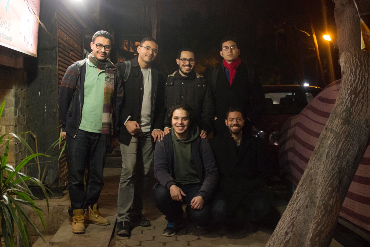
فريق “مواصلة للقاهرة” من أعلي اليسار. محمد محروس، ا. جابر، إ عبيد، محمد حجازي، ر. زياد، أ حجازي. وأيضا ولكن غير موجودين بالصورة. ه. العقدة، ت. طه”
حسام: تجمعنا تجربتنا المشتركة بيننا وبين كل فرد يعيش بالقاهرة، المواصلات هي مصدر لتوتر غير محدود، التلوث وعدم اليقين دائما حول كيفية الوصول لجهة ما وكم ستستغرق من الوقت. فأفضل وسيلة لمعالجة ذلك هي من خلال وسائل النقل العامة، رغم أن هذا صعب على أي شخص ان يفهمه، أي شخص شهد تخطيط الرحلات على الإنترنت أو عند السفر للخارج يريد ان يكون بمقدوره فعل نفس الشيء عند العودة مرة أخرى إلى القاهرة.
محمد حجازي: نحن ثمانية أشخاص نعمل معا فى “مواصلة للقاهرة” وقد أتينا من خلفيات مختلفة، ولكن يجمعنا رغبتنا في البحث عن تطبيقات على أرض الواقع، انا خبير اقتصادى من خلال التدريب وعملت فى مجال تطوير البرمجيات. حسام نشأ في القاهرة ودرس التخطيط العمراني، باحثان في التخطيط العمراني، متخصص في GIS ، مطور اعمال ذو خبرة، ومتخصص في تكنولوجيا المعلومات يقوم بالعمل في اطروحة الدكتوراة الخاصة به. حتى الآن فكل ما وصلنا له من عمل تم اعتمادا على تمويلنا الذاتي وجهودنا التطوعية، فرغبتنا المشتركة في ابقاء هذه البيانات متاحة للجميع في سبيل المنفعة العامة هو ما جعل ارتباطنا كفريق وثيقا، ونبحث حاليا بنشاط عن مصادر أخرى للتمويل من أجل الابقاء على هذا ممكنا.
ما هو الشيء الأكثر أهمية الذى تذكره عن “مواصلة للقاهرة”؟
حسام: أكثر ما يمكن ذكره هنا هو كيف كان من الممكن لمجموعة من الباحثين ان يتركوا علامة على حياة ملايين الناس من خلال أن يضعوا نظام خرائط لمخططات الرحلات لوسائل النقل العام فى أيدى الجمهور، حتى في مدينة كبيرة مثل القاهرة. نامل أن نكون جزءا من مناقشة عامة حول كيفية عمل نظام النقل العام بالقاهرة فعلا، و لكى نبدأ لاحقا التفكير في كيفية تطوير نظام نقل معقد كالذي في القاهرة. نحن بالاساس باحثين، وعقود من الأبحاث أثبتت ان زيادة عدد السيارات، وتوسيع الطرق، وازالة الترام، ووبناء المدن الطرفية خارج المدينة لا يخفف الازدحام، وما يرتبط به ذلك أيضا من الآثار الاقتضادية والبيئية السلبية، نأمل أن يساهم عملنا في إيجاد خيارات نقل أسهل لجميع المصريين عند استخادمهم لوسائل النقل العام.
في مؤتمر LOTE5 سيناقش محمد حجازي “مواصلة للقاهرة” خلال دورة من دورات المؤتمر بشهر فبراير فى بروكسل.
]تم تحرير هذه المقابلة واختصارها[
Translation by: Abdelmonem Ibrahim, an Egyptian architect with a passion for architecture, technology and innovation.
عبدالمنعم ابراهيم
معمارى مصري مهتم بالعمارة والتكنولوجيا والابداع
Cairo from Below co-founder Nicholas Hamilton interviews Transport for Cairo co-founders Mohamed Hegazy and Houssam Elokda
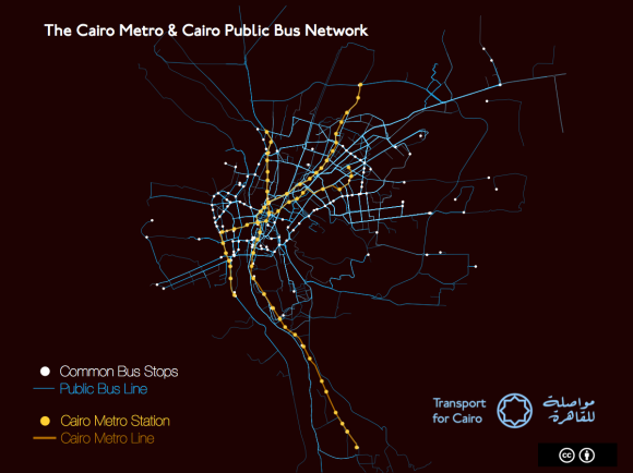
Visualization of Cairo’s Buses and Metro – routes and stops by Transport for Cairo
How was the idea of Transport for Cairo born?
Houssam: I was walking down the street when I got a rambling call from my long-time friend Hegazy about a project in Nairobi he had just learned about. He told me about a team that had put together a map of the city’s “informal” microbus system and opened the data to all. It was called Digital Matatus. Hegazy said he thought we could bring the idea to Cairo where privately run microbuses cover a huge share of the city’s transportation needs. I was so excited about the idea that I stopped walking, went into the nearest coffee shop, and opened my laptop to start researching. I became obsessed with the question of how we–as private citizens–could provide millions of Egyptians access to useful knowledge about the existing transport network and empower them to use that knowledge to improve their daily lives. We established the basics of our research methodology and started Transport for Cairo that day!
What does data have to do with getting around a city? What are hoping to achieve with this project?
Houssam: The whole purpose of this project is to ease people’s access to public transport in Cairo. Before you can think about designing improvements to a transit system, you must first understand the system you have. We want to get this data to as many people as possible. We want public and private transit operators, researchers, private app developers and the public to make inquiries with this data, to understand the system as it is.
M. Hegazy: Look, if you go to a trip planning website like Google Maps or Bey2ollak–which is one of the most popular apps in Egypt today–they can only give you driving directions, or maybe walking. They can’t give you public transit options because no one has collected that information or made it accessible, so it encourages people to take a car because they don’t have reliable information on public transit options.
We started with the idea to map Cairo’s microbuses because no map exists thinking we could integrate that microbus information with the government owned bus and Metro systems. We quickly learned there isn’t complete information on the Metro or the government owned buses–let alone the microbuses–that is available to the public, app developers, or to researchers. You need standardized data about routes, stops, trip length and schedules to make a map and power trip planning software, a type of data programmers call GTFS or General Transit Feed Specification.
This isn’t easy in the best of circumstances, but you need to understand how huge and complex the transportation system in Cairo is. Greater Cairo is home to 18 million residents, 20 on weekdays and rapidly growing in both geography and population. The Metro has 61 stations; it is 65 km long and expanding. There are somewhere between 450 to 880 government owned bus lines, and those two systems don’t satisfy Cairo’s transport needs so we also have the additional transportation system of microbuses, which are further sub-categorized into ones with license to run on particular routes, unlicensed ones on particular routes, and unlicensed ones that run in general directions similar to a shared taxi. No one really knows how many run, what routes they follow, or how many people use informal bus system, but the assumption goes that it covers 40% of the city’s transport needs, which is on par with the public bus system.
How do Cairenes get transit information right now? How does this compare with other types of information access?
Hossam: Right now knowledge about the public transport system is mostly orally transmitted and there is a lot of uncertainty about the quickest option. Making transport data available will put knowledge of the fastest and cheapest routes at the touch of your fingers: you will be able to use apps on every smart phone to tell you how to get somewhere and how long it will take.
M. Hegazy: With the exception of the Metro, there is very little information for me as a citizen to access. The government publishes a PDF document with the public bus routes, but it ends there. Even if the data exists, it isn’t publicly accessible and can’t be used for trip planning.
Do you need a smartphone to benefit from Transport for Cairo?
Houssam: There is a big misconception that people in the developing world don’t have smart phones. In Egypt, smartphone usage is currently at 15.5 million users–who have data plans–and growing. Over the next three years, it is projected to increase to 28 million, or more than 50% of the adult pop of the country.

A privately operated minibus under license from the Egyptian authorities (Creative Commons CC-0)
M. Hegazy: Let me address another common misconception. Public transit users are not only of poor status, everyone uses public transit. People with smartphones are increasingly on public transit. This is true the world over where free wifi and cell service is being rolled out underground. Also, while we envision printed system maps could be produced, there is one final misconception worth addressing. Changes don’t have to be universal to be helpful: even an incremental improvement can have huge positive impact and be worthwhile.
You mentioned earlier the Digital Matatus project in Nairobi. I’m a big fan of the project and had the privilege of being involved in some of its early planning. Could you describe how that project unfolded and how Transport for Cairo is different?
M. Hegazy: I learned about Digital Matatus in the free, online book Beyond Transparency, and then learned more from online urban sources like Wired, Atlantic and Guardian and academic papers. The team there spent months riding the matatus recording thousands of stops and hundreds of routes with a custom app and GPS from sources. We subsequently met and sought advice from some of the university partners of the project such as Professor Jacqueline Klopp at Columbia University’s Center for Sustainable Urban Development, and Sarah Williams, Director of the Civic Data Design Lab at Massachusetts Institute of Technology (MIT). [Disclosure: Professor Klopp is also an adviser to Cairo from Below]. From them we learned how important institutional partnerships would be to successfully implementing the work.

Microbuses lined up under the Dokki Flyover (Creative Commons CC-0)
One of the challenges we face here in Cairo is that the city is three or four times as populous and large as Nairobi. Unlike Nairobi and its matatus, Cairo’s system isn’t primarily centered on microbuses. Cairo has many types of mass transit: the Metro, buses and microbuses–in addition to walking and other forms of non-motorized transit which are often overlooked when talking about transportation.
The microbuses have a complex identity in Cairo and elsewhere. Here people know they are usually the fastest option and often the cheapest, but they are sometimes also viewed as polluting, and prone to aggressive drivers and accidents. As researchers we also recognize it is a system highly adaptive to supply and demand, and is not centrally planned by anyone. One of our research questions seeks to analyze the system’s resiliency in the face of the unexpected.
We started with mapping a couple of microbus routes, looked at the data and realized we had to revise our strategy. We found through our research that for Transport for Cairo to put meaningful data into the hands of citizens, the project needed to get way bigger and encompass all forms of mass transit data. We had to map the entire system.
This is a huge undertaking, how can a team of eight researchers map the entire transportation system of one of the world’s largest cities?
M. Hegazy: The short answer is step by step. Our team of eight mostly volunteers wouldn’t get anywhere if we tried to map the whole of Cairo at once so we broke the now much larger project into phases. The first phase was creating and publishing a full set of data for the Metro. That phase is done so people can now at least begin developing apps to provide trip planning that includes the Metro. We did the easiest part first to prove to ourselves and others that we had something meaningful to contribute.
The World Bank has mapped 450 of Cairo’s 880 public bus routes as well as the Metro system, but did not include information on stop locations (image and project described on World Bank website)
The next phase was government owned buses. The World Bank had done an earlier project on the GIS mapping of the official bus lines, but not stops, trip length or frequency so it wasn’t helpful in trip planning. Because the World Bank has been open to sharing their data, we are currently creating a full GTFS dataset for the buses. We can create a first version of this data without fieldwork. Stations may not be identified with a sign, but they emerge in practice.
Houssam: Our contribution is to deduce the rules and patterns that tell you most of what you need to know about how people move within the city: to understand the logic of a seemingly out of control system. To see the structure of this complex system you need to collect lots, and lots of data, analyze it and clean out the noise. The city may have grown organically, but it and its transport grew according to rules. We are writing those rules down for the first time in the form GTFS dataset for buses. This will be a huge step forward, but is only the means to the end.
The end is something people in New York and other large cities now take for granted: an accessible map and trip planning on multiple platforms in the palm of their hand. Like Digital Matatus, as Transport for Cairo we are part of a global discussion underway about how to democratize technology. We are learning how to make global technology standards like GTFS, which was designed for Europe and the US, work for the cities of the developing world.
What comes next? What kind of reception have you been getting?
M. Hegazy: The next phases will depend on funding and partnerships. We need to field test and verify this data for both the government owned buses and the microbuses. There is a lot of work still to do.
People in the planning domain here in Cairo are excited about this and they also are guarded because they aren’t sure it can be done and because others have tried this before. People give us credit for having such rigorous research methodology. Partnerships with universities, international organizations, and the Egyptian government will give us an even stronger legitimacy as we move forward. We are actively looking for both funding and partnerships.
Tell me a little about who you are and what from your personal backgrounds led you to start Transport for Cairo? What holds this group together?
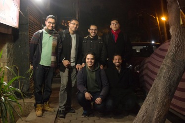
Transport for Cairo Team: Clockwise, from top left: M. Mahrous, I. Gaber, E. Ebeid, M. Hegazy, R. Zeid and A. Hegazy (Missing are: H. Elokda, T. Taha).
Houssam: We were united by an experience shared among every person who’s lived in Cairo. Transportation is a source of infinite stress, pollution and uncertainty about how to get places and how long it will take. The best way to address this is through public transit, yet that same transit is difficult for anyone to understand. Anyone who has seen trip planning for mass transit online or when traveling abroad wants to be able to do it back home in Cairo.
M. Hegazy: There are eight of us working on TfC, we come from many backgrounds but are united by a passion for research with real world applications. I am an economist by training and had worked in software development. Houssam grew up in Cairo and came from research and urban planning background and works to improve cities around the world. Others in our team include a programmer, two urban researchers, a GIS professional, an experienced business developer and an information technology professional working on his PhD. Our work has been advanced entirely through self-funding and dedicated volunteer efforts. Ensuring that the data we generate remains open and accessible as a public good fundamentally glued our team together. We’re actively trying to attract grant funding to make this possible.
What is the most important thing to remember about Transport for Cairo?
Houssam: It is possible for a group of passionate researchers to touch millions of people’s lives through a project like putting smart trip planning for mass transit in the public’s hands, even in a city as large as Cairo. We hope to be a part of a conversation about how the city’s transportation actually functions so we can begin the later work of thinking about how to improve a transport system as complex as Cairo’s. We are fundamentally researchers and decades of research has shown that adding cars, widening roads, removing trams, and building peripheral cities outside of town does not alleviate congestion, and associated negative economic and environmental impacts. We hope our work contributes to people finding good public transit options for all Egyptians.
M. Hegazy will be discussing Transport for Cairo at a session of the LOTE5 conference in February in Brussels.
[This interview was edited and abridged]


هذه معلومات مفيدة تم مشاركتها …. اتضح أن ما كنت أبحث عنه حتى الآن هو في هذه الورقة ، ويسعدني جدًا العثور على العديد من المقالات في هذه المدونة ، أنا مهتم بجملك أعلاه ، بناء رأي في رأيي لماذا؟ لأنك كتبته بلغة يسهل فهمها.